 |
| The cover of Marjorie's recently published book. |
Marjorie has a few disabling conditions that make her an excellent measure of what is required of a trail to be considered an Easy Walk. In short, an Easy Walk would be on flat to mild terrain, have minimal low rocky conditions to navigate, and could be anywhere from a quarter mile to two and a half miles in length. Any slightly more challenging terrain might last only 20-30 feet. A step or two might be encountered at a bridge. Any wheelchair accessible path would constitute an Easy Walk, but some Easy Walks will extend beyond wheelchair accessibility.
Read on to learn some Easy Walk locations in the Connecticut River Valley, and find out about Easy Hikes too.
 |
| An accessible trail makes an Easy Walk at DAR State Forest in Goshen. |
Easy Walks may include quiet roads, rail trails, cemeteries, state and town parks, and conservation properties. Quiet roads are likely to be plowed in winter, whereas rail trails are not, although in warmer conditions they are often melted free of snow and ice naturally.
 |
| Riverside Park in Sunderland |
Northfield - Ames Trail: Half mile forested wheelchair accessible loop with pond views, benches, and an observation deck.
Turners Falls - Canalside Rail Trail: 3 mile paved path from Unity Park to Connecticut River with varied urban and natural settings, multiple access points, and one noteworthy hill between Depot Street and Greenfield Road.
Turners Falls - Migratory Way: Opposite canal from Canalside Rail Trail at Eleventh Street. One mile paved road along water to dead end. Very light car traffic, plowed in winter. Opportunity to see waterfowl especially late fall through spring.
Greenfield - Bike Path: Paved pedestrian trail starts at Nash Mill Road park along the Green River and connects to the town of Greenfield via Conway Street.
Montague - Ferry Road Triangle: Off Turners Falls Road find Ferry Street near Rau's Sunoco station. Intersect with Greenfield Road a quarter mile down. Parking for 1-2 cars roadside just north of this intersection. Stroll a 2 mile triangle of quiet roadways in beautiful farm country: Greenfield Road to Old Greenfield Road to Ferry Road and back to your car.
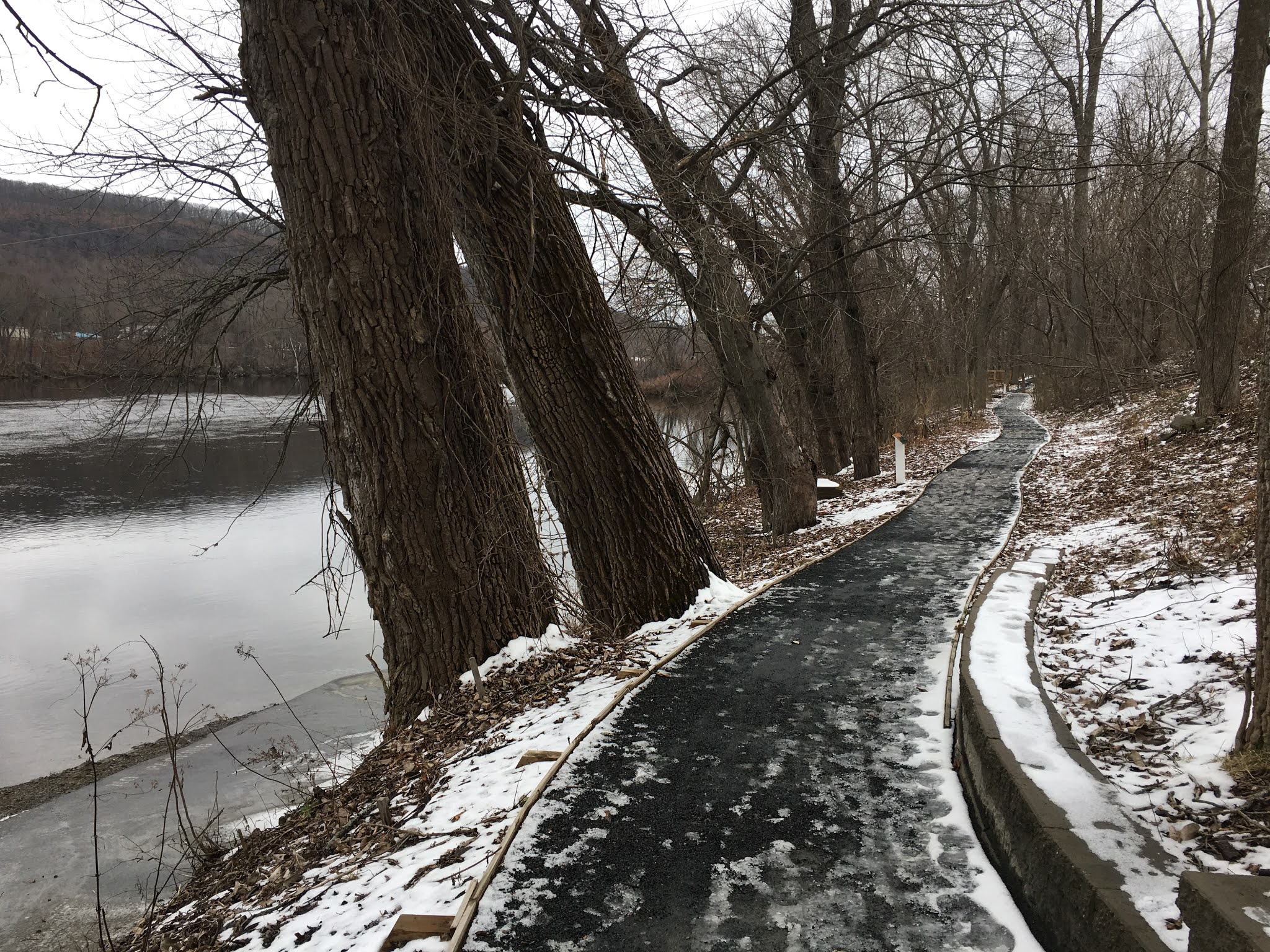
Sunderland - Riverside Park: a 3/4 mile wheelchair accessible trail partially around playing fields with a segment along the river. Park at the Sunderland Library at 20 School Street. Bathrooms available if the library is open.
 |
| Melted conditions allow for easy walking along the Norwottuck Rail Trail in winter. |
Hadley - Fort River Accessible Trail: 1 mile wheelchair accessible loop through fields, woodlands and forest with quiet water and mountain views. Portapotties in parking lot.
Northampton - Northampton Rail Trail System: Multi use path through Northampton with connecting trails to Amherst, Belchertown, Easthampton, Florence, Hadley, Southampton and Williamsburg. Main hub is behind 203 King Street (Taco Bell/KFC).
Easthampton - Manhan Rail Trail: 6 miles of paved path in Easthampton.
Holyoke - Mt. Tom State Reservation Lake Bray Accessible Trail: Half mile wheelchair accessible trail loop starts near Lake Bray restrooms off Route 5 entrance. Some moderate grades and pond views with accessible fishing docks and picnic area. The pond house is usually open for bathroom use year round.
Chicopee - Chicopee State Park: 1/4 mile paved roadway along a reservoir starts with a modest downgrade and levels out offering an "out and back" wheelchair accessible route. Going beyond the first significant downhill at the end of the reservoir brings you to a paved Healthy Heart trail loop with strenuous grades - a Challenging Hike - through the forest that borders on the Air Force Base.
Westfield - Stanley Park: A half mile paved pathway through a variety of park attractions including Carillon Tower, dinosaur tracks, Asian architecture and playground.
 |
| Rattlesnake Gutter offers an Easy Hike in Leverett. |
Erving/Northfield - Dorsey/River/Pine Meadow Roads - extensive stretch of quiet back road along the Connecticut River. Find Dorsey Road off Route 2/2A east of the French King Bridge. Park along the road, view the confluence of the Millers and Connecticut Rivers, walk underneath the French King Bridge and continue on, turning around at any point. Park at Riverview Picnic Area and walk River Road (dirt) in either direction. Pine Meadow Road - pick a safe spot to park along the road and enjoy walking paved section through agricultural fields. While mostly level, there are some grades that suggest this is more of an Easy Hike. Drive the whole thing first to determine your best location to walk.
 |
| Winter view of Mt. Grace from AMC cabin. |
Leverett - Rattlesnake Gutter Road: Two mile walk out and back from Village Co-op in Leverett. Dirt road with very light traffic, closed in winter and not plowed. Gradual ascent and descent in each direction, follows a rocky gorge. Bathrooms in Co-op. Adjacent trails from the road climb upward.
Agawam - Robinson State Park: Paved road way through the park offers a gated section at the end extending the road for a wide stroll through the forest along the Westfield River. Some moderate extensive grades tilt this towards an Easy Hike.
 |
| Easy walking at Wentworth Farm alongside a pond. |
Amherst - Amethyst Brook: Kestrel Trust property off Route 9 in S. Amherst. Open fields and level forest along the brook with wide wooden bridges. Popular dog walking spot. A trail network that will become a Challenging Hike as it heads up Mt. Orient.
Amherst - Cole and Podick: Two Kestrel Trust properties at one location off Route 116 on Amherst/Sunderland line across from the end of Sunderland Road. Very level terrain through woodlands surrounded by open fields. Can be wet and narrow foot bridges make this an Easy or Challenging Hike depending on conditions, abilities and chosen distance.
 |
| Wheelchair accessible trail at Puffers Pond. |
Amherst - Wentworth Farm: Networking trail system on Kestrel Trust conservation property in open fields and open woodlands with pond views on mostly level terrain. Wheelchair accessible to start. Park on Old Farm Road off Route 9. Circumnavigate adjacent fields. Following the Ken Cuddeback and Harvey Allen trails will get you into Easy and Challenging Hike territory, with wet areas, staircase bridges and train track crossings.
Hilltowns:
 |
| Big trees grace accessible trail at DAR State Forest. |
Shutesbury - New England Trail segment Lake Wyola to Montague Road. Park at Carroll Holmes Recreation Area and follow a gradually climbing forested roadway trail northward until it ends at paved Montague Road and turn around to return. Can be abbreviated at any point. May be a Challenging Hike in sections.
 |
| Snowy winter trail at Elizabeth Cole requires good boots. |
- Minimize outdoor recreational time to limit potential exposure to COVID-19;
- Stay within solitary or small groups, and avoid gatherings of ten or more people;
- Practice social distancing of at least six feet between individuals;
- Administer healthy personal hygiene, such as handwashing for at least 20 seconds;
- Participate in only non-contact recreational activities;
- Leave a park or area should large gatherings begin to build; and,
- Stay home if ill, over 70, and/or part of a vulnerable population
No comments:
Post a Comment